Street | Pedestrian counting
Outdoor Pedestrian and Cyclist Counting on City Streets
SensMax TAC-B 3D-WP is a radar-based pedestrian and cyclist counting solution for city streets, sidewalks, urban corridors, and public access routes. It helps municipalities, transport planners, and infrastructure managers collect reliable street usage data, monitor pedestrian flow, and understand how urban spaces are used over time. The system supports urban mobility monitoring, street traffic analysis, and public space planning with accurate statistics for investment decisions, infrastructure upgrades, and Smart City reporting.
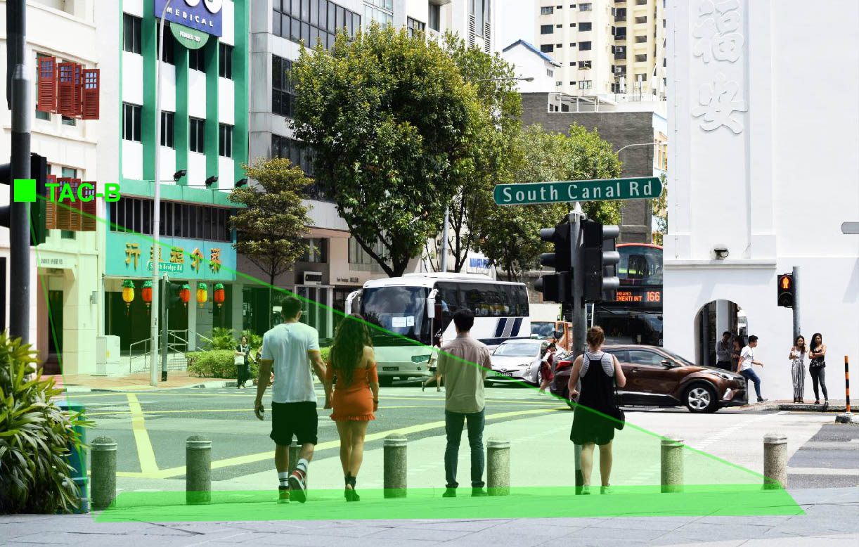
Pedestrian counting on an urban street using SensMax TAC-B 3D-WP radar sensor
Why Pedestrian and Cyclist Counting Matters
City streets, sidewalks, and urban corridors carry a changing mix of pedestrians, cyclists, scooters, and local traffic throughout the day. Understanding how these spaces are used is essential for urban mobility planning, pedestrian safety improvements, and evaluation of infrastructure projects.
Reliable street usage statistics help municipalities compare traffic levels between locations, identify the busiest routes, and measure before-and-after results of mobility improvements. These insights support better planning for sidewalk upgrades, bicycle lanes, crossings, street furniture, and public investment priorities.
Pedestrian and cyclist counting helps cities and operators:
- identify the busiest sidewalks, corridors, and crossing points
- compare traffic trends across seasons, weekdays, and project phases
- measure the effect of new bicycle lanes or pedestrian improvements
- support budget planning with real urban mobility data
- prioritize street design and public space investments
People Counting Technology for City Streets
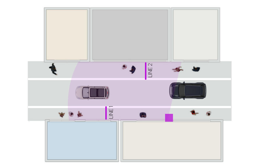
SensMax TAC-B 3D-WP uses 60 GHz mmWave radar technology for pedestrian flow monitoring on city streets and urban traffic analysis. Unlike simple beam counters, the radar sensor analyzes movement vectors, direction, and speed within the monitored zone. This makes it suitable for open urban environments such as sidewalks, squares, street segments, and mixed pedestrian and cyclist routes where movement is not limited to a narrow passage.
The radar-based detection principle works without filming or recording personal data, which makes the system suitable for GDPR-compliant monitoring in public spaces. TAC-B 3D-WP can detect pedestrians, cyclists, and scooters and supports configurable lines and zones for flexible traffic analysis in urban installations.
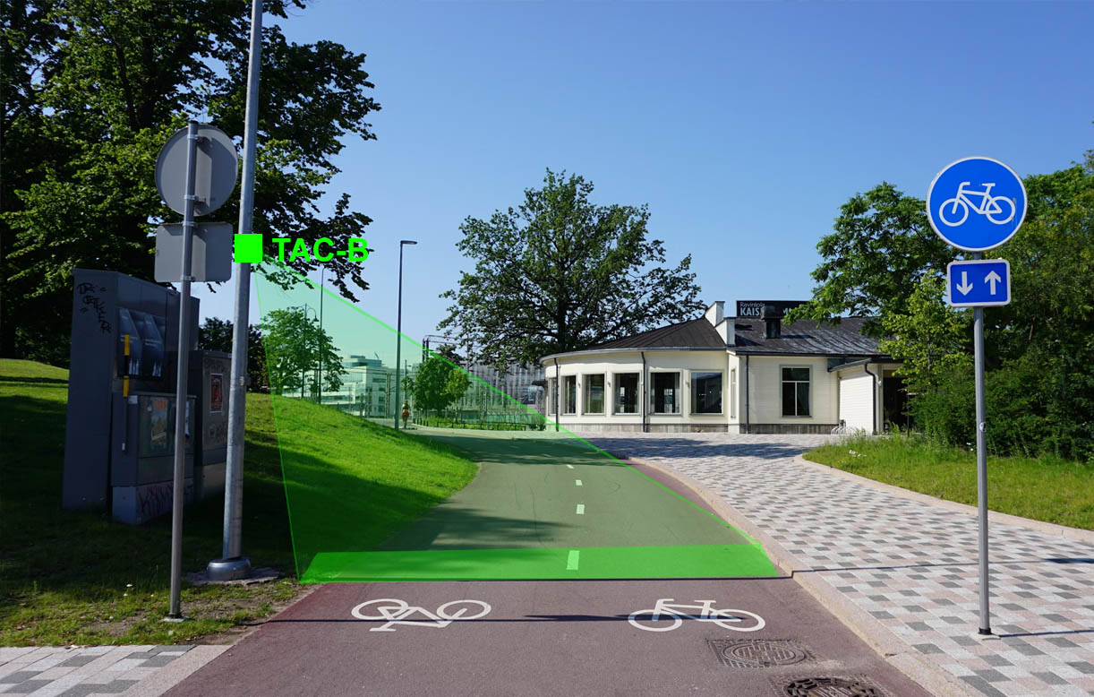
Counting bicycles and pedestrians on an urban street using SensMax TAC-B 3D-WP
How It Works
The TAC-B 3D-WP radar sensor is typically installed on a sidewall, lamp post, pole, or similar vertical structure at approximately 2.5-3 m above the monitored sidewalk or street segment. When a person, cyclist, or scooter passes through the radar coverage area, the sensor detects movement, evaluates direction, and records counting events according to the configured zone logic.
Each sensor can monitor movement within up to a 10 m range and a viewing angle of up to 120°, covering approximately 100 m² under suitable installation conditions. Movement speed can be used to support traffic classification, for example separating pedestrian and bicycle traffic on shared urban routes. Data is stored internally and transmitted through local Wi-Fi to the SensMax Cloud platform, where it becomes available for dashboards, reports, and long-term trend analysis. Integration is also supported through API and MQTT for GIS, BI, and Smart City systems.
Data, Analytics and Monitoring
SensMax provides urban pedestrian and cyclist analytics through a cloud-based dashboard where municipalities and operators can review hourly, daily, weekly, and seasonal street traffic statistics. This makes it possible to identify peak movement times, compare locations, and track long-term changes in pedestrian and bicycle traffic across urban spaces.
The collected data supports urban mobility analysis, public space monitoring, and project evaluation for sidewalks, crossings, cycle lanes, and street redesign initiatives. Reports can be accessed through a web browser or exported for planning and reporting. API and MQTT connectivity also support integration with GIS systems, transport dashboards, business intelligence tools, and broader Smart City analytics environments.
Installation
The recommended installation height for TAC-B 3D-WP on city streets is approximately 2.5-3 m, depending on sidewalk width, route geometry, and required coverage area. Typical mounting surfaces include sidewalls, lamp posts, poles, traffic light structures, and other stable urban supports positioned near sidewalks, street segments, crossings, or bicycle corridors.
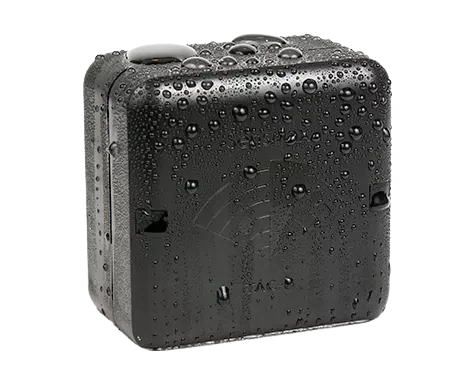
The sensor is housed in a weather-protected enclosure suitable for year-round urban deployment. Power is supplied from a standard AC 220 V to DC 12 V adapter, and an optional SensMax Mini UPS can provide short-term backup during power interruptions. With reliable Wi-Fi connectivity and local backup storage, the system supports continuous street traffic monitoring in rain, fog, snow, bright sun, and darkness.
Pedestrian and bicycle footfall counting on an urban street using TAC-B 3D-WP
Key Technical Advantages
- Radar-based pedestrian and cyclist counting without cameras or phone tracking
- Suitable for pedestrians, bicycles, and scooters in mixed urban environments
- GDPR-compliant anonymous detection for public streets and sidewalks
- Up to 10 m detection range with up to 120° field of view
- Configurable lines and zones for flexible urban traffic analysis
- Local Wi-Fi connectivity for cloud reporting without a cellular plan
- API and MQTT support for GIS, BI, and Smart City integrations
- Internal data storage for resilient operation during network outages
- Low-maintenance operation in changing outdoor weather conditions
Real-World Applications
- City sidewalks and urban pedestrian corridors
- Street crossings and public squares
- Bicycle lanes and mixed-use mobility routes
- High-street retail areas and shopping streets
- Transit-adjacent walkways and station approaches
- Waterfront promenades and central public spaces
- Redeveloped streets and urban mobility pilot projects
Business Impact
Understanding how many pedestrians and cyclists use a street, when they move, and which routes are most active helps cities make better infrastructure decisions. Pedestrian and cyclist counting supports sidewalk planning, bicycle lane evaluation, pedestrian safety improvements, and project result measurement using real urban mobility data instead of assumptions.
Street usage monitoring also supports Smart City planning and transport analysis. By measuring pedestrian and bicycle flows across urban corridors, municipalities can compare locations, justify budgets, prioritize improvements, and prepare evidence-based reports for funding applications and long-term mobility planning.
Example in Action
A city installs SensMax TAC-B 3D-WP radar sensors along a central street corridor and near a redesigned crossing area. After several weeks of monitoring, the collected data shows that pedestrian traffic is highest during late afternoon hours, while bicycle traffic increases significantly during morning commutes and weekend periods. The data also reveals that one upgraded sidewalk section is used much more heavily than surrounding segments.
Based on this information, the municipality adjusts crossing priorities, supports additional bicycle infrastructure in the busiest zone, and uses the traffic statistics to justify investment decisions for future street improvement phases.
FAQ
- How does a city street pedestrian counter send data?
The sensor can store data locally and transmit it through Wi-Fi to the SensMax Cloud platform for remote access, reporting, and analytics. - Does the system collect personal data?
No. TAC-B 3D-WP uses radar-based movement detection and does not record images, video, or personal identifiers. - Where should the sensor be installed for accurate street counting?
It is typically mounted on a sidewall, lamp post, pole, or similar structure at approximately 2.5-3 m height above the monitored street or sidewalk section. - Can the system continue working during a Wi-Fi outage?
Yes. Internal backup storage keeps data locally and uploads it after the network connection is restored. - How accurate is radar pedestrian and cyclist counting outdoors?
Under suitable installation conditions, the system typically achieves up to 99% accuracy in moderate density and about 93% in crowded conditions. - What power options are available?
The system uses a standard AC 220 V to DC 12 V adapter, and an optional SensMax Mini UPS can provide short-term backup power.
Technical Details
| Feature | Details |
|---|---|
| Application | Pedestrian and cyclist counting on city streets, sidewalks, urban corridors, and public access routes |
| Technology | 60 GHz mmWave radar people counting sensor |
| Movement tracking | Direction-aware radar movement detection with speed-based traffic interpretation |
| Detection angle | Up to 120° field of view |
| Detection range | Up to 10 m |
| Coverage area | Approximately 100 m² under suitable installation conditions |
| Detected objects | Pedestrians, cyclists, scooters |
| Counting logic | Configurable lines and zones for urban traffic analysis |
| Data cadence | Automatic data collection with cloud-based reporting and export options |
| Connectivity | Wi-Fi / API / MQTT |
| Enclosure | Weather-protected outdoor housing |
| Mounting height | Approximately 2.5-3 m |
| Installation type | Sidewall, lamp post, pole, or similar vertical urban support |
| Storage | Internal SD card backup memory |
| Power supply | AC 220 V to DC 12 V adapter; optional SensMax Mini UPS for short-term backup |
| Operating conditions | Suitable for outdoor use in rain, fog, snow, bright sunlight, and darkness |
| Accuracy | Up to 99% in moderate density and about 93% in crowded conditions |
| Maintenance | Low-maintenance automatic operation after setup |